

Kingston, Jamaica – July 13, 2026 – Jamaica has earned one of the highest distinctions in the global Geographic Information Systems (GIS) community after receiving the 2026 Esri President’s Award during the 2026 Esri User Conference held in San Diego, California.
The prestigious award was accepted by Dr. the Most Honourable Andrew Holness, Prime Minister of Jamaica, on behalf of the Government of Jamaica. Presented annually by Esri, the global leader in GIS technology, the President’s Award recognizes organizations and governments that have demonstrated exceptional leadership and innovation in the application of geographic information systems to solve real-world challenges and improve decision-making.
Jamaica’s recognition reflects the country’s continued commitment to leveraging GIS and location intelligence to support evidence-based policymaking, strengthen national planning, enhance public service delivery, and advance the development of an integrated national geospatial infrastructure. The award also highlights the nation’s growing reputation as a regional leader in the use of geospatial technology to drive sustainable development and resilience.
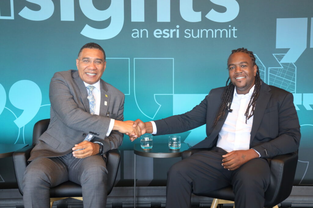
Representing Spatial Innovision Limited at the conference was a team led by Deputy Chief Executive Officer Roshaun Clarke, more popularly known as “Bay-C” from hit-making Reggae group, TOK. He had the opportunity to meet with Prime Minister Holness as Jamaica’s achievement was celebrated on the international stage.
“As Esri’s exclusive regional distributor for the Caribbean, we are incredibly proud to witness Jamaica receive this distinguished recognition,” said Clarke. “This award demonstrates what is possible when governments embrace geospatial technology as a strategic tool for national development. It is an achievement that not only celebrates Jamaica’s progress but also inspires the wider Caribbean to continue investing in GIS and location intelligence.”
For more than two decades, Spatial Innovision Limited has partnered with governments, utilities, private sector organizations, and academic institutions throughout the Caribbean to implement innovative GIS solutions that improve operational efficiency, strengthen resilience, and support smarter, data-driven decision-making. Jamaica’s recognition reinforces the growing impact that geospatial technology is having across the region.
The award also comes at an exciting time for the Caribbean geospatial community as Spatial Innovision prepares to host the inaugural Spatial ArcGIS User Conference Experience Jamaica, set to take place September 29–30, 2026, at the AC Hotel Kingston.
The conference will bring together GIS professionals, government agencies, business leaders, educators, developers, and technology innovators from across the Caribbean and beyond for two days of technical learning, knowledge sharing, networking, and collaboration. Attendees will have the opportunity to explore the latest ArcGIS innovations, hear from industry experts, discover real-world success stories, and gain practical insights into how GIS continues to transform organizations and communities.
Jamaica’s receipt of the Esri President’s Award further underscores the significance of hosting this landmark regional event, highlighting the country’s leadership role in advancing geospatial excellence throughout the Caribbean.
Spatial Innovision Limited extends its heartfelt congratulations to the Government of Jamaica and all stakeholders whose vision and commitment have contributed to this remarkable achievement. The company remains committed to supporting the continued growth of the region’s geospatial ecosystem and empowering organizations to make better decisions through the power of location intelligence.
About Spatial Innovision Limited
Spatial Innovision Limited is the Caribbean’s premier geospatial solutions company and the exclusive Esri distributor for the English-speaking Caribbean. The company provides GIS technology, consulting, training, and technical support, helping governments, businesses, and organizations leverage location intelligence to make smarter decisions and build more resilient communities.